Tuesday 18 February 2020

Announcing: mapguide-react-layout 0.13

Here it is. The last release of mapguide-react-layout in its current form. There will be bugfix releases as required but from this release onwards, mapguide-react-layout will be re-branded as something else, and when I figure out what that will be called, you will find out here first!

Here's the highlights of what's new and changed in this release.

Revamped External Layer Manager

Already showcased in previous dev diary entries, the 0.13 release features a revamped external layer manager allowing you to add external layers from file-based or remote WFS/WMS data sources.

The External Layer Manager also has the following new changes since my dev diary posts.

We've tweaked the WMS select tool to now also display the feature in our client-side selection overlay if the WMS GetFeatureInfo response contains geometry data.


You'll also notice that the WMS feature tooltip is styled differently (to distinguish it from the regular feature tooltip) and is also now also close-able (indicated by the clickable [x])

This WMS Query tool is a separate widget, which you can add to your application by including the following widget definition in your Application Definintion and referencing that widget from a toolbar or menu.


 1
 2
 3
 4
 5
 6
 7
 8
 9
10
11
12
<Widget xsi:type="UiWidgetType">
      <Name>WmsQuery</Name>
      <Type>WmsQuery</Type>
      <Location />
      <Extension />
      <ImageUrl>images/icons.png</ImageUrl>
      <ImageClass>select</ImageClass>
      <Label>WMS Query</Label>
      <Tooltip>Click to query for features in WMS layers at the point you click</Tooltip>
      <StatusText />
      <Disabled>false</Disabled>
</Widget>

Also for vector layers, you can now style points with image icons through the style editor.


Storybook-based demo

This release is the first one to be showcased in storybook.

Legend Search Filtering

The legend now includes a search box to easily drill down big layer/group structures if you need to rapidly locate a specific layer for toggling. Useful for maps with very large layer/group structures.


Template Changes - Aqua

Thanks to the use of react-rnd, we now finally have resizable dialogs in the Aqua Template!


Template Changes - Other

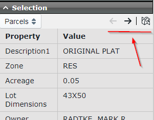
For all templates, making a map selection will now automatically give focus to the selection panel.


The only exception to this behavior is the sidebar template in mobile view, where rather than automatically flying out a full screen selection panel, we just flash a red indicator over the selection panel toggle to let you know there are selected features to look at.


Removed "Invalid Task Pane" warning

If you work with multi-map configurations, you may have noticed this warning on Task Pane content when switching between maps.


This warning is shown when the passed MAPNAME and SESSION parameters for any loaded URL in the Task Pane does not match the mapname/session of the map you're currently looking at.

Upon further reflection, this warning is overzealous as any Task Pane content that needs to know the actual map name and session id can simply request this information from the viewer APIs in javascript. So this warning has been removed in this release.

SVG icon replacements

Some of the image based icons used by the viewer have been replaced with SVG icon equivalents from the blueprint icon set. This is to enable the possibility of scalable versions of these user interfaces in future releases.


Other Changes

There is a whole load of other fixes and minor improvements which you can find in the full 0.13 release notes in the download link below.

Download

Friday 7 February 2020

mapguide-react-layout dev diary part 25: There is a general purpose map viewer in there.

As I am tidying up the remaining loose ends for the upcoming 0.13 release, I am going to be giving the project a slight re-branding and revised mission statement after this release.

Because although I've touted the mapguide-react-layout project as a "modern map viewer for MapGuide", the fact of the matter is that only a small portion of the viewer codebase concerns integration with the services provided by MapGuide. The rest of the codebase builds on top of the already solid foundations provided OpenLayers, React and TypeScript that can also work with other web mapping servers and services.

I haven't come up with the specifics yet, but my current thoughts so far are:
  • This project will be renamed to something else (name TBD)
  • The npm package will have a different name. The mapguide-react-layout packages up to 0.13 will still remain on npm, but when the time is right I'll put a deprecation warning on mapguide-react-layout to let you all know about the new package and that you should migrate over to it.
  • MapGuide-specific functionality and features of the viewer will be extracted and separated out. How this separation will be done TBD.
With this move, there is potential for some nice cross-pollination:

  • I could pivot the vscode-map-preview extension to be based on this viewer (and its kitchen sink of built-in functionality) instead of raw OpenLayers strung together with other libraries and re-creating functionality I already take for granted in mapguide-react-layout.
  • I'm parking my static map publishing idea for Maestro because the prospect of having a mapguide-react-layout viewer that need not necessarily have MapGuide Server dependencies is a more attractive proposition to build this idea on top of.
  • There's opportunities for adoption of this viewer in other projects where the hard MapGuide Server dependency would've nixed such opportunities.
So when 0.13 finally drops, that will be the end of mapguide-react-layout in its current form. Not because I'm done with the project, but because it's time for this project to evolve.

Saturday 1 February 2020

Announcing: vscode-map-preview 0.5.1

This release restricts the display of the new preview UI buttons to only files whose extension we know to be preview-able


The preview buttons now only display for the following file extensions:

  • .geosjon
  • .csv
  • .kml
  • .gml
  • .gpx
  • .igc

Although preview-able content may exist within .txt, .xml and .json files, these formats are too generic to reliably determine ahead of time if this is actually the case (before the preview command is run).

The preview commands can still be run the "old fashioned" way for all other cases.